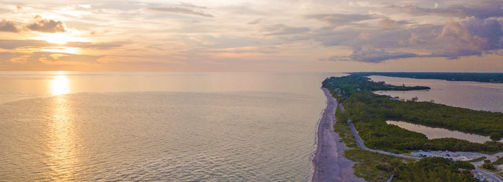
The Barrier Islands - called "The Keys"

Dr. Stephen P. Leatherman is Professor and Director of the Laboratory for Coastal Research at Florida International University. He received his Ph.D. in Environmental (Coastal) Sciences from the University of Virginia and completed his undergraduate degree in Geosciences at North Carolina State University.
Before joining FIU, Stephen was Professor and Director of the Laboratory for Coastal Research at the University of Maryland, Director of the National Park Research Unit at the University of Massachusetts, Amherst, and Assistant Professor in the Department of Geology at Boston University.
Unparalleled beauty at Siesta Key Beach
Siesta Key Beach consistently ranked as one of the top beaches in the US. Renowned beach expert Dr. Stephen Leatherman recognized Siesta Key Public Beach's exceptional features and awarded it a top spot on his coveted list.
A beach like no other
Siesta Key's stunning ultra-white quartz sand sets it apart from other beaches. This unique feature gives the beach its mesmerizing appearance and contributes to its excellent rating. Experience the pleasure of walking on soft, powdery sand that feels like no other beach.
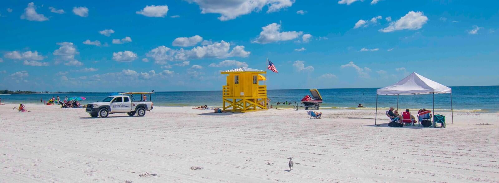
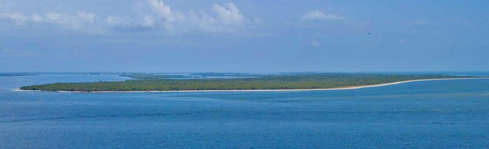
The Keys on Florida's Sun Coast
Anna Maria Island and Longboat Key - the closest it can get to Tampa
Your gateway to the stunning beaches of Manatee County!
Discover your perfect beach lifestyle
Experience the best of both worlds with Manatee County's 27 miles of pristine white sand beaches. Whether you're looking for a relaxed and laid-back atmosphere or a more upscale and refined setting, Anna Maria has the perfect property for you.
Anna Maria Island: Beachy and Laid Back
Escape to the charming island of Anna Maria, where you'll find a beachy, laid-back vibe perfect for those seeking a carefree coastal lifestyle. Enjoy endless sun, sand, and relaxation days in this idyllic paradise.
Longboat Key: Formal and Buttoned Up
If you prefer a more formal and sophisticated atmosphere, Longboat Key is the place for you. This exclusive island offers upscale clubs, world-class golf courses, fine dining establishments, and a thriving community of like-minded individuals.
Your dream property awaits
Whether you're interested in a beachfront condo with breathtaking ocean views or a luxurious villa nestled in a private gated community, Anna Maria Island has a wide selection of properties to suit every taste and budget. Take advantage of the opportunity to own a piece of this tropical paradise.
Discover the Perfect Coastal Living Experience
While Anna Maria boasts several stunning and vibrant beaches, Longboat Key offers a unique charm of its own. Although not as renowned for its beach, the island captivates with its exclusive golf club and course that serves as the focal point for residents and visitors alike.
Your Slice of Paradise, Away from the Crowds
With over two million annual visitors to Longboat Key and Anna Maria, it's essential to find your peaceful retreat amidst the hustle and bustle. But while the number of visitors may seem daunting when divided by 365 days, rest assured that there are certain times when the crowds dissipate, allowing you to enjoy your island escape fully.
Anna Maria Island
Population: 7,082 (2013)
Length: 10.8 miles
Width: .05 to 1 mile
Longboat Key
Max length: 7.021 miles
Max Width: 1.988 mile
Population: 8,500 (2005)
St Armands and Lido Key - Home of the famous St Armands Circle
Your Gateway to Exquisite Properties in the Paradise of Lido Key and St Armands Circle
Discover the best of both worlds
Once you cross the bridge from Longboat Key to St.Armands Key/Lido Key, you'll find a perfect blend of stunning white sand beaches and a vibrant, cosmopolitan atmosphere.
Lido Key - where beach dreams come true
Indulge in the ultimate beachside living on Lido Key, with its pristine white sand beach that stretches for miles. Enjoy breathtaking ocean views and immerse yourself in a relaxed coastal lifestyle.
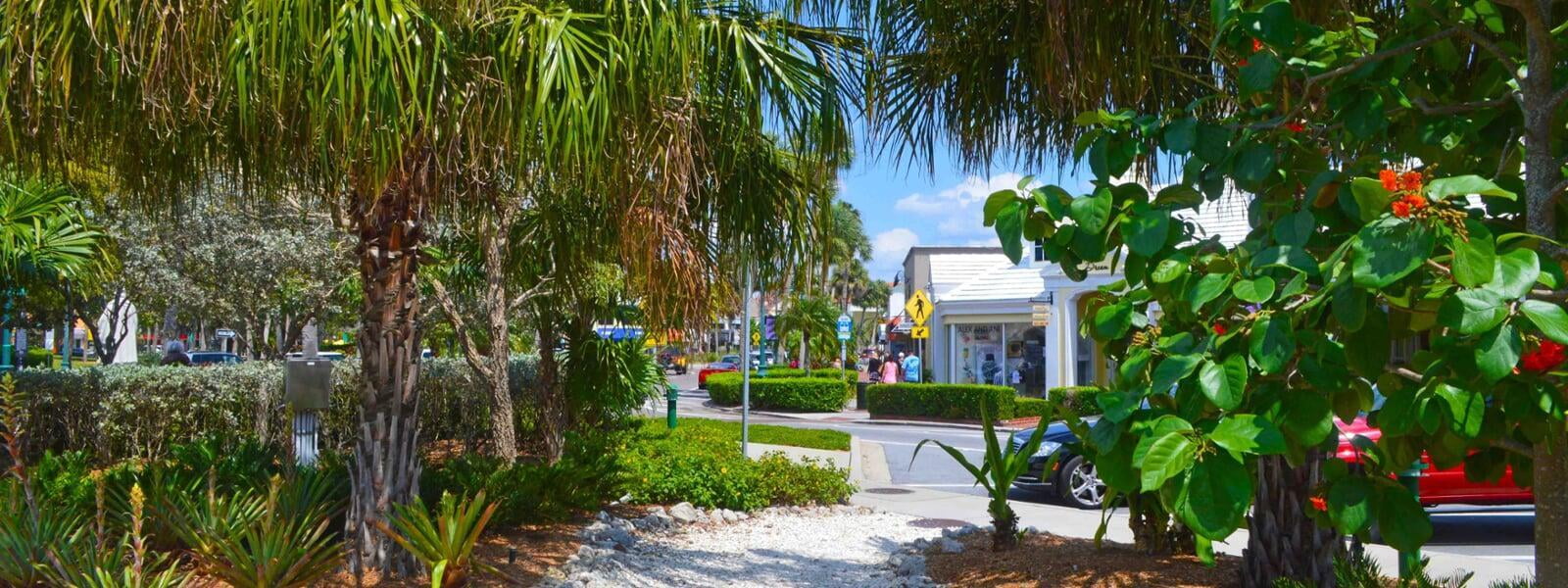
St. Armands Circle - a world-class destination
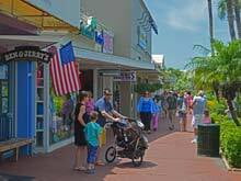
Step into the heart of St. Armands Circle, an iconic hub that captivates visitors from around the globe. With its charming boutiques, eclectic shops, and diverse restaurants offering international cuisine, St Armands Circle is renowned for its vibrant ambiance and unforgettable shopping and dining experiences.
St Armands and Lido Key
Population: 3,068
Length: 3.6 miles
Width: 1.4 miles
Bird Key
Welcome to Bird Key:
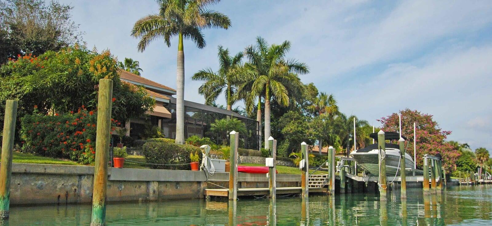
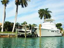
Discover the ultimate waterfront living on Bird Key, an exclusive island neighborhood with luxurious homes and endless boating opportunities.
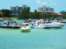
A Boater's Dream Come True
Bird Key offers a boater's paradise like no other. With deep water canals and a private yacht club, you'll have easy access to the stunning Sarasota Bay and beyond. Whether you're an avid boater or simply appreciate the beauty of waterfront living, this is the place for you.
Bird Key offers a boater's paradise like no other. With deep water canals and a private yacht club, you'll have easy access to the stunning Sarasota Bay and beyond. Whether you're an avid boater or simply appreciate the beauty of waterfront living, this is the place for you.
Unrivaled Waterfront Properties
Immerse yourself in luxury with over 300 single-family homes that boast breathtaking bay-front views. Many of these properties come with deep water dockage, ensuring that your boat is always ready for your next adventure. The waterfront lifestyle you've always dreamed of is within reach on Bird Key.
Immerse yourself in luxury with over 300 single-family homes that boast breathtaking bay-front views. Many of these properties come with deep water dockage, ensuring that your boat is always ready for your next adventure. The waterfront lifestyle you've always dreamed of is within reach on Bird Key.
Bird Key Yacht Club: Where Luxury Meets Recreation
Experience the epitome of elegance at the recently remodeled private Bird Key Yacht Club. Indulge in world-class amenities, including dining options, social events, and recreational facilities. As a resident of Bird Key, you'll have exclusive access to this prestigious club.
Experience the epitome of elegance at the recently remodeled private Bird Key Yacht Club. Indulge in world-class amenities, including dining options, social events, and recreational facilities. As a resident of Bird Key, you'll have exclusive access to this prestigious club.
The Perfect Location
Nestled between Downtown Sarasota and St. Armand's Circle, Bird Key offers unparalleled convenience and proximity to renowned shopping, dining, and entertainment destinations. Enjoy the best of both worlds - a tranquil island retreat just moments away from vibrant city life.
Nestled between Downtown Sarasota and St. Armand's Circle, Bird Key offers unparalleled convenience and proximity to renowned shopping, dining, and entertainment destinations. Enjoy the best of both worlds - a tranquil island retreat just moments away from vibrant city life.
Bird Key
Population: 865
Length: 1.3 miles
Width: .8 miles
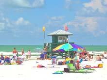
Siesta Key
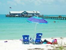
Siesta Key is the next barrier island on the trip further south. Two drawbridges are connecting this tropical paradise with the mainland. The four beaches and the village are the main attraction of Siesta Key. The rated #1 Siesta Public Beach is the most popular one. The brilliant white sand, the emerald water, and a perfect blue sky drive thousands of visitors to Siesta Key every year.
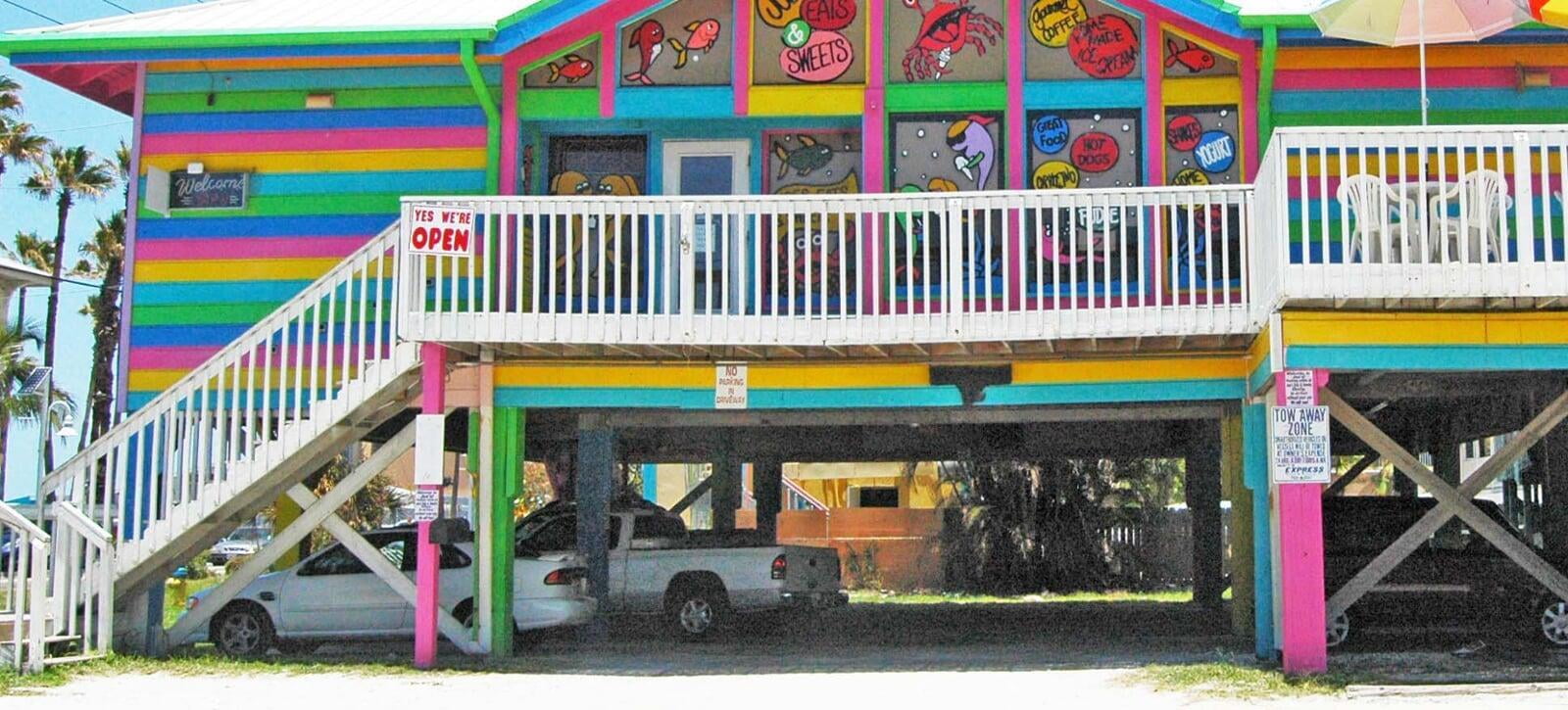
The Village of Siesta Key, located at the north end of the island, is the other main attraction. Shops, boutiques, restaurants, and bars, with and without live music, are entertaining sun-seekers who come to the key from nearly every corner of the earth.
Siesta Key is by far the busiest of all the barrier islands and it can turn into a crazy spot on public holidays. Unfortunately, parking is never unlimited on islands - especially not on public holidays. Primarily the south-bridge acts as a bottleneck once in a while, therefore, try to get off the island on the 4th of July weekend and you will believe us. You might find yourself trapped in a traffic jam for hours. However, that is the price to pay for a beautiful experience on the beach. Hardcore Siesta Key fans don't mind- if they want to go to their #1 beach ...they will go.
Siesta Key
Population: 6,565 (2010)
Length: 8 miles
Width: 1.5 - 0 .1 miles

Casey Key
Casey Key, like Siesta Key, also connected by two drawbridges, is the next barrier island. The north-bridge, called "Blackburn Point Bridge," is a historic swing bridge. Very few bridges of that kind are left left in the US. At certain times, this 100 year old bottleneck is a pain because it has only one lane, but nobody wants to get rid of the old bridge, and if you have time to go to the beach, you should have five minutes to wait at the bridge.
Once on the island, you will feel that the isolated eight miles long Key is a different world. There is only very little commercial activity at the south end of the island. No high- rise buildings, no hotels, and no restaurants. Wow! Can you starve to death on Casey Key? Well, not really. There is the famous "Casey Key Fish House" Restaurant right by the historical north-bridge, and there are "The Pelican Alley" and "Pop's Sunset Grill" right by the south-bridge, but on the mainland.
Furthermore, when you drive to the Jetty, there is the "North Jetty Fish Camp," and a Concessions Stand, where you can get at least a hot dog and a cold one. So, dare to go to Casey Key, you may survive your trip.
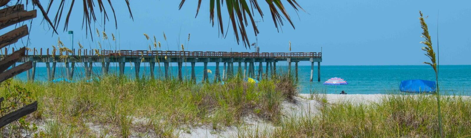
Nokomis Beach - the County's oldest Beach
Nokomis Beach is the only public beach on Casey Key, but the beach is a long stretch of white sand. You are perfectly safe there because lifeguards will keep an eye on you. New amenities, boardwalks through the dunes, and a boat ramp attract beach-goers and boaters from the mainland.
By the way, Nokomis Beach is the oldest beach in Sarasota County. The Beach Plaza, which is part of the parking lot, was designed and built in the 1950s by Jack West. He was a member of the renowned Sarasota School of Architecture. After 50 years in service, the buildings needed a spring makeover, which was done in 2008.
Amenities include lifeguards, boardwalk, canoe/kayak launch, boat ramp and dock, the historic Nokomis Beach Plaza, picnic shelters, playground, volleyball court, beach-side restrooms, bay-side portable restrooms, and free parking.
Real Estate is unique on Casey Key
Some of the most expensive homes located in Sarasota County are on Casey Key. You won't even notice, because many of them are hiding behind lush tropical landscaping, almost invisible to the visitor's eyes. Nobody would even assume that there are beautiful homes behind that jungle. Find out yourself and take the only road that runs down from the island's north end to the south end. Roll down the windows, let the warm breeze in and enjoy - it is an impressive ride.
At the south end of Casey Key is the Venice Jetty, which ends the trip by car. This channel is one of the boatable waterways connecting the Intracoastal waterway with the Gulf of Mexico. To get to the next island, which is the Island of Venice, you have to leave Casey Key and drive on US-41 towards Venice. There is no bridge and no ferry you could use to cross the Jetty.
The Drum Circle on Nokomis Beach
The famous drum circle gathers near the lifeguard tower on the Beach each Wednesday and Saturday evening. The time of the event varies throughout the year because it is based on sunset. The Nokomis Beach Drum Circle is a very family-friendly event that lasts around an hour or so. All you need to bring is some good cheer, a drum, and a chair. However, if you only want to listen and watch, you can do that too. It is fun.
Island of Venice or Venice's Isle

Manasota Key
Manasota Key
Population: 1,229
Length: 6miles
Width: less than 1 mile

Don Pedro and Little Gasparilla Island
Don Pedro and Little Gasparilla Island used to be separate islands, but somehow they merged a long time ago. You can only reach those islands in the sun by ferry or with a private boat. The 150 yard trip with that ship is pretty expensive when you want to take your beloved car with you. You might be better off leaving your car on the mainland, but that is your decision. The ferryman will bring you to the other side for money.
The ferry is for the people who live there, or for vacationers who rent a home. It makes sense to take the car with you if you live on the island for an extended time, especially when the ferryman cuts you s special deal for using the ferry daily.
Most island residents are short term vacationers or snowbirds; only a few people live there year-round. Our take is that living like Robinson Crusoe may appeal to some people, but when you look a little closer, not everybody may like the "remote lifestyle" after a while.


Gasparilla Island
The last Island is Gasparilla, with the city of Bocca Grande. Bocca Grande is known for the World's Richest Tarpon Tournament. Since 1930, anglers from all over the world are flocking to this former pirate hideout. The angler who catches the biggest fish is the winner, of course. Once they took the poor fish's weight and size, they will release them into their natural habitat again. Nobody wants to cook them because the meal would not be too pleasant. Tarpon is a game fish, and anglers like him because he is a strong fighter. Of course, you can eat them, but you would be spitting bones all night long.
Now, at Gasparilla Sound, you have reached the end of the world. While the Venice Jetty or Stump Pass are relatively "small" barriers, the Gasparilla Sound is a real one. There used to be a harbor for seagoing vessels from where phosphate was shipped, but that is history. With the invention of chemical fertilizers, the port became obsolete.
The Sound is wide and deep, and "DO NOT SWIM" signs indicate that this is by far not the right spot to go swimming. There is always a strong current, either going out into the Gulf or going inwards. Combined with a strong wind, this can be a deadly mixture. So, enjoy the lighthouse museum and the view. If you want to go swimming, go around the corner, and you are on the Gulf-side. A hundred yards can make a huge difference, and you will come home alive.
Don Pedro-, Night-, Palm-, Little Gasparilla Island
Population: less than 1,000
Length: 5 miles
Width: 0.4 miles max.
Gasparilla Island
Population: 1,500
Length: 5 miles
Width: 0.8 miles max.
Captiva and Sanibel Island
The barrier islands' string continues with North Captiva Island and Sanibel Island on the other side of the 1.5-mile wide channel. That string proceeds until you reach Key West and the Straits of Florida.